


Voting District 0112112000002, Arenac County, Michigan
About
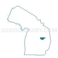
Outline

Summary
| Unique Area Identifier | 595867 |
| Name | Voting District 0112112000002 |
| County | Arenac County |
| State | Michigan |
| Area (square miles) | 12.01 |
| Land Area (square miles) | 11.98 |
| Water Area (square miles) | 0.03 |
| % of Land Area | 99.74 |
| % of Water Area | 0.26 |
| Latitude of the Internal Point | 44.01944490 |
| Longtitude of the Internal Point | -83.96943440 |
Maps


Graphs
Select a template below for downloading or customizing gragh for Voting District 0112112000002, Arenac County, Michigan


Neighbors
Neighoring Voting District (by Name) Neighboring Voting District on the Map
- Voting District 0110336000001, Arenac County, MI
- Voting District 0112112000001, Arenac County, MI
- Voting District 0114758000001, Arenac County, MI
- Voting District 0117614000001, Arenac County, MI
Top 10 Neighboring County Subdivision (by Population) Neighboring County Subdivision on the Map
- Deep River township, Arenac County, MI (2,149)
- Standish township, Arenac County, MI (1,900)
- Lincoln township, Arenac County, MI (942)
- Arenac township, Arenac County, MI (903)
Top 10 Neighboring Place (by Population) Neighboring Place on the Map
Top 10 Neighboring Unified School District (by Population) Neighboring Unified School District on the Map
Top 10 Neighboring State Legislative District Lower Chamber (by Population) Neighboring State Legislative District Lower Chamber on the Map
Top 10 Neighboring State Legislative District Upper Chamber (by Population) Neighboring State Legislative District Upper Chamber on the Map
Top 10 Neighboring 111th Congressional District (by Population) Neighboring 111th Congressional District on the Map
Top 10 Neighboring Census Tract (by Population) Neighboring Census Tract on the Map
- Census Tract 9705, Arenac County, MI (4,249)
- Census Tract 9702, Arenac County, MI (3,441)
- Census Tract 9703, Arenac County, MI (2,872)